
The following hike takes you from the remote shepherd village of Dobёrdol to another, less remote shepherd village in Kosovo (Milisevc). Milisevc has a good road connection with the town of Peja and more and more mountain huts in this village are being used for tourist purposes.
For a less demanding hike, the trail can be divided into two parts. You can follow the eastern trail at the junction (WP 3c) and descend to Bjeshka e Belegut, where you can find accommodation, camping facilities and fresh food in the shepherds' summer huts. Remember that there are no GPS waypoints from WP 3c to Bjeshka e Belegut, but the trail is still quite easy to find. Bjeshka e Belegut is connected to Milisevc (SS 11c) by a gravel road, which is easy to find with a map.
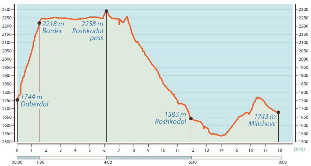
The hike begins at an altitude of 1741 m at the mountain hut of Dobёrdol (WP 13b) and climbs in a north-easterly direction up to an altitude of 2210 m at the border between Albania, Kosovo and Montenegro (WP 1c). The route continues in a north-easterly direction, with small climbs and drops along the border between Montenegro and Kosovo.
At SS 2c, we turn right (north) at the crossroads. The path on our right leads to Babino Polje, Montenegro.
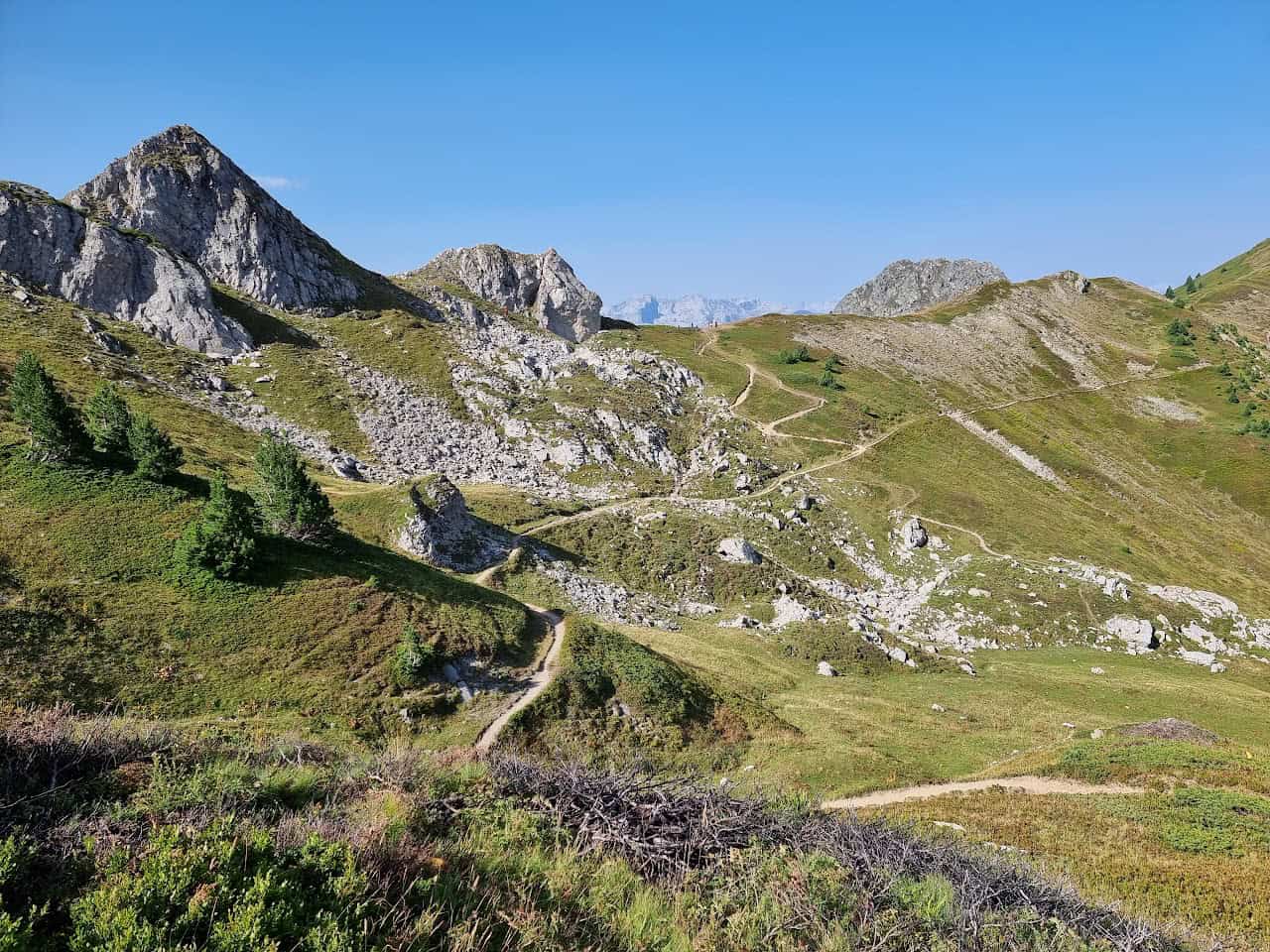
At the next crossroads (WP 3c), keep left (heading north). The eastern path leads to Bjeshka e Belegut. Our route follows the western side of Maja e Qenit (the summit in front of us, a few hundred metres from SS 3c). The western slope of Maja e Qenit is steep but relatively short (about 500 m hike) and is also the best option to get to the other side of this mountain (WP 4c) and head north to the Roshkodolit pass (WP 5c).
If you find it too difficult to conquer this mountain slope, you can take the route via Bjeshka e Belegut to Milisevc, which is longer but easier - a longer but simpler option (mainly on unpaved paths).
From the Roshkodolit Pass, the trail leads down into the valley. At SS 6c, we cross the river and continue along the trail from the west side. We meet the gravel road at SS 7c, followed by the village of Roshkodol at SS 8c - an optional place for an overnight stay.
Milisevc is located approx. 5 kilometres west of Roshkodol and can be reached via a dirt road. Keep left at SS 9c and 10c. This day hike ends in Milisevc (WP11c), where you can spend the night in the village's mountain huts.